Canyon conditions change rapidly, so you should plan for extreme temperatures, pack your sun protection and ample water; choose the South or North Rim based on access and season, secure lodging, permits, or shuttle reservations early, acclimate to elevation, respect wildlife and trail etiquette, pack layered clothing and sturdy footwear, and schedule hikes at sunrise or late afternoon to avoid heat and crowds.
Key Takeaways:
- Plan timing and access: choose South Rim for year-round services, North Rim seasonally; reserve lodging/permits early and check road or shuttle schedules before travel.
- Pace hikes and set turn-around times: distances and elevation make canyon hikes harder than they look-allow twice the usual descent/ascent time and never underestimate heat or fatigue.
- Hydrate and protect from sun/altitude: carry plenty of water, electrolyte replacements, broad-brim hat, sunscreen, and layer clothing for temperature swings.
- Practice rim and trail safety: stay well back from edges, use railings, watch footing on loose rock, and avoid solo or off-trail travel without experience and proper gear.
- Respect wildlife and Leave No Trace: don’t feed animals, pack out all trash, stick to designated trails, and have a basic emergency kit and way to communicate if coverage is limited.
Best Times to Visit the Grand Canyon
Plan around elevation and season: the South Rim sits near 7,000 ft (2,134 m) and is open year‑round, while the North Rim (~8,000 ft / 2,438 m) closes mid‑October to mid‑May; inner‑canyon temperatures can top 110°F (43°C) in summer and winter brings snow on rims. You’ll get milder weather and fewer people in spring (April-May) or fall (September-October), whereas summer offers long days but crowded viewpoints and afternoon monsoon storms.
Seasonal Considerations
Summer (June-August) delivers the highest visitation and inner‑canyon heat plus July-September monsoons with sudden thunderstorms and flash‑flood risk. Winter gives crisp air and snow at rim viewpoints but limited services on the North Rim. Spring and fall offer comfortable rim highs, wildflowers or fall color, and more reliable trail conditions; for example, April averages cooler rim temps and far fewer mid‑day heat hazards than July.
Avoiding Crowds
Visit on weekdays and in shoulder months (April-May or September-October), arrive before 8:00 AM or after 4:00 PM, and use the South Rim shuttle to skip the Village parking scramble; Mather Point and Bright Angel Trailhead fill up fastest at sunrise. Target less‑visited overlooks like Desert View or Moran Point for quieter stretches.
For hiking, start predawn on Bright Angel or South Kaibab to beat heat and crowds-many day hikers finish by late morning. If you want solitude, consider backcountry permits for an overnight or head to North Kaibab or the remote Tanner Trail (experience required). Also check seasonal vehicle restrictions on Hermit Road and use park shuttles to shave minutes off parking searches and avoid traffic congestion on peak days.
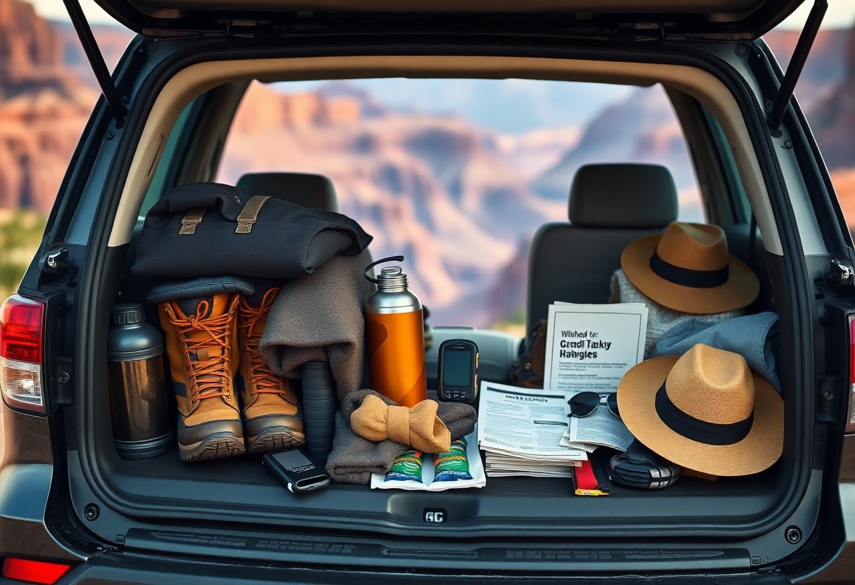
Essential Packing Tips
- Your layered clothing system: moisture-wicking base, insulating mid, wind/rain shell
- Your broken-in, supportive hiking boots (4-6 in) and breathable socks
- Your hydration plan: 3-4 L per person for strenuous summer hikes + filter
- Your sun kit: SPF 50 sunscreen, sunglasses, wide-brim hat, UPF clothing
- Your electronics: 200-300 lm headlamp and 10,000-20,000 mAh power bank
- Your safety kit: compact first-aid/blister kit, map/GPS, permits for backcountry
Clothing and Footwear
Temperatures can swing 40-60°F between rim and inner canyon, so you should pack a layer system: a moisture-wicking base, an insulating midlayer (fleece or synthetic), and a lightweight waterproof/windproof shell. Bring UPF 30+ shirts, a wide-brim hat, and thin gloves for cooler mornings; wear wool or synthetic socks and broken-in ankle-support boots (4-6 inches) to prevent blisters, and carry an extra pair of socks for rim-to-river hikes.
Gear and Supplies
Water and navigation dominate gear choices: plan 3-4 liters per person for strenuous summer hikes (or at least 1 L per hour in hot conditions), carry a reliable filter like a Sawyer Mini or SteriPEN if you refill from natural sources, and bring a 10,000-20,000 mAh battery pack for phone/GPS. Pack a 200-300 lumen headlamp with spare batteries, trekking poles for steep descents, and a compact first-aid/blister kit; physical maps are imperative where cell service drops.
You should stash water caches at trailheads if you expect high heat and use a CamelBak for hands-free sipping on long descents; a lightweight emergency bivy or shelter improves safety if plans change. Keep your food calorie-dense-700-1,000 kcal per day for strenuous multi-day hikes-and carry extra electrolytes. Assume that you pack an additional 1-2 liters per person beyond planned consumption when hiking below the rim.
Climbing and Hiking Safety
When you descend from the South Rim you lose roughly 4,800-5,000 feet and temperatures can jump 20-30°F, so pace conservatively and set early turnaround times. Use sturdy boots and trekking poles to protect knees on loose switchbacks, check forecasts for thunderstorms and avoid exposed ridgelines, and carry a basic first-aid kit plus navigation tools. Tell the park or a trusted contact your route and expected return to speed rescue if needed.
Trail Etiquette
When you meet others on narrow trails, yield to uphill hikers and step to the downhill side at a wide spot so traffic flows safely. Give mule trains and pack animals absolute priority-handlers will signal and you must stand clear until they pass. Keep groups single-file on switchbacks, limit noise, and pack out all trash and toilet paper to protect soils and prevent conflicts.
Staying Hydrated
Carry at least 3 liters (100 oz) per person for typical day hikes and plan on about 1 liter per hour in hot conditions; rim-to-river routes may require 4-6 liters depending on length and heat. Sip frequently rather than gulping and use electrolyte mixes to replace sodium lost in heavy sweating. Prehydrate with 16 oz (~0.5 L) in the two hours before you start.
Monitor hydration by urine color-pale straw is good while dark yellow signals you need more-and watch for dizziness, headache, or muscle cramps as early warning signs. Take water breaks every 20-30 minutes and add 250-500 ml during strenuous climbs since the final ascent demands the most fluid. Treat any backcountry water (filter, chemical purifier, or boil) before drinking because surface sources can carry Giardia and other pathogens.
Transportation Options
Getting to the Grand Canyon
If you fly, Phoenix Sky Harbor (PHX) is roughly 230 miles – about a 3.5-4 hour drive to the South Rim; Flagstaff Pulliam (FLG) is about 80 miles (1.5-2 hours) and is the quickest regional option. Las Vegas (Harry Reid, LAS) puts you 120 miles from the West Rim (≈2.5 hours) or ~275 miles to the South Rim (4-5 hours). Small commercial flights and charters operate to Grand Canyon National Park Airport (GCN) near Tusayan for quick access.
Navigating Within the Park
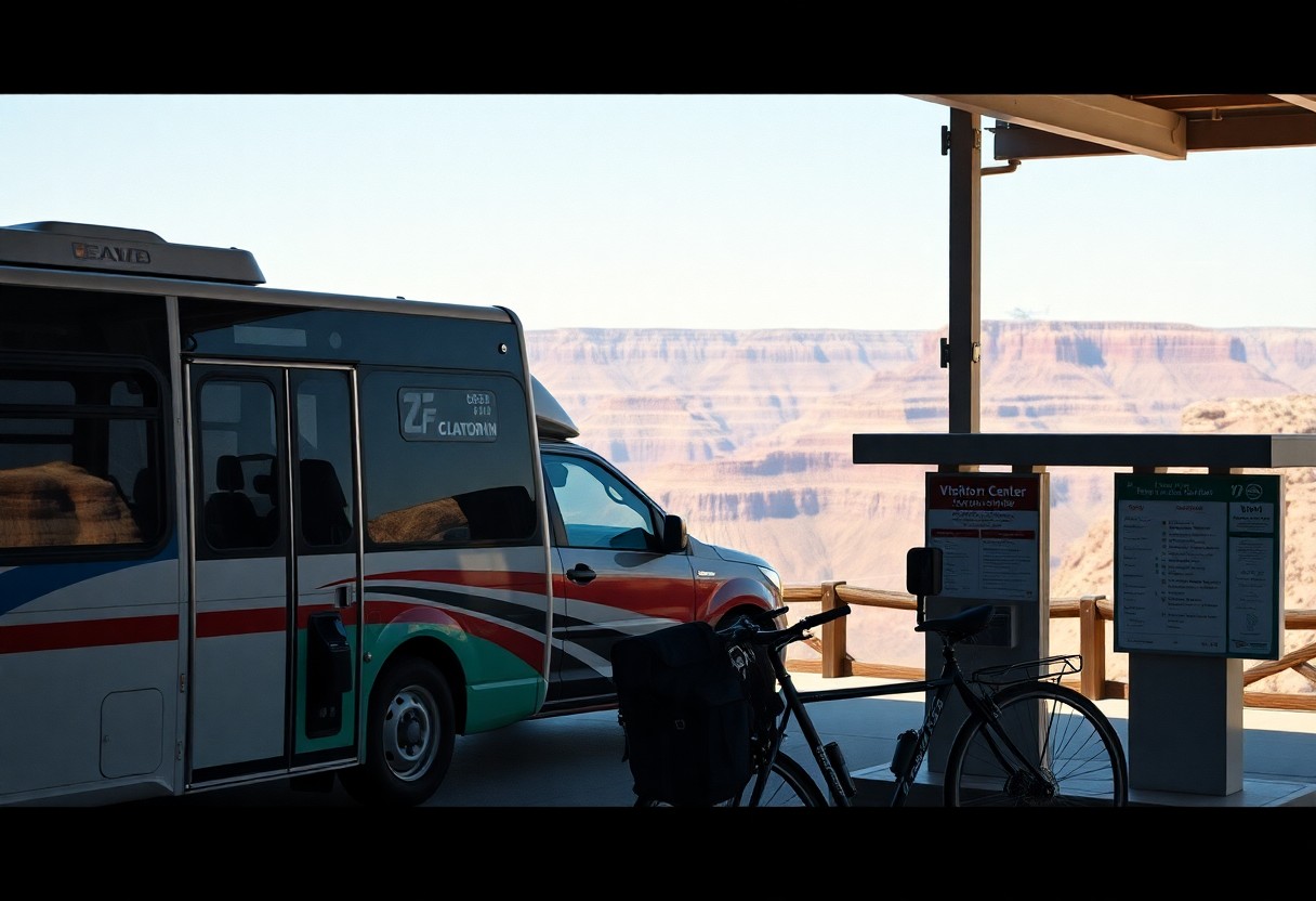
You’ll rely heavily on the South Rim’s free shuttle system to reach major overlooks like Mather Point and Yavapai Point; buses typically run every 10-20 minutes during peak season and Hermit Road is shuttle-only for most of the year. Parking near Grand Canyon Village fills early, so plan to use shuttle stops, the Tusayan park-and-ride (about 7 miles south of the rim), or arrive before 8:00 AM for roadside spots.
Desert View Drive stretches about 25 miles east of Grand Canyon Village with multiple scenic stops (Navajo Point, Desert View Watchtower) you can drive yourself year-round, while Hermit Road’s 7-mile corridor is best accessed by shuttle, bike, or on foot; bike rentals in Tusayan let you cover several overlooks efficiently, and provided shuttle timetables and trail maps are available at visitor centers to help you sequence viewpoints and hikes.
Accommodation Choices
Campsites and Lodges
You’ll find reservable campgrounds like Mather Campground (South Rim, ~327 sites) via Recreation.gov, while North Rim’s Grand Canyon Lodge and campground operate seasonally (mid‑May-mid‑Oct) and demand early booking. Historic lodges – El Tovar, Bright Angel, Yavapai – fill 6-12 months ahead, especially summer. Phantom Ranch stays require advance entry through the Phantom Ranch lottery or a rafting/mule package and are scarce. If you prefer flexibility, reserve a campsite or a Maswik/Thunderbird room, and plan backups for peak holiday weekends.
Nearby Towns
You can base yourself in Tusayan (about 2 miles from the South Rim) for quick park access and air tour options at Grand Canyon National Park Airport, or in Williams (≈60 miles) to ride the Grand Canyon Railway. Flagstaff (≈80 miles) offers an airport (FLG), car rentals, and more dining options. Sedona (≈115 miles) pairs well for sightseeing. Each town varies in price and winter accessibility; choose based on your itinerary and whether you want proximity or amenities.
Stay in Tusayan if you want dawn rim access without early driving; expect higher nightly rates and shuttle availability to the Village. Williams gives lower rates, Route 66 character, and direct train departures-budget 1-1.5 hours driving time. Flagstaff supplies specialty gear, medical facilities, and larger grocery stores; flights into FLG or Phoenix (PHX, ~230 miles from the canyon) are convenient. Off‑season (Nov-Feb) you often find 30-50% lower hotel rates, but North Rim services may be closed.
Must-See Attractions
South Rim Highlights
At the South Rim you can walk the paved Rim Trail for up to 13 miles with panoramic views, visit Mather Point and Yavapai Observation Station for geology exhibits, and explore Grand Canyon Village where Bright Angel Trail begins – a 9.5‑mile round‑trip to Plateau Point is popular for fit hikers; shuttle buses serve Hermit Road from March to November, easing parking constraints.
Unique Experiences
You can book a sunrise helicopter tour over the canyon, join a ranger-led geology walk at the Yavapai Museum, or raft a 1-2 day trip on the Colorado River; heli rides often depart from Tusayan and last about 45 minutes, while guided raft trips require permits and advance booking with licensed outfitters.
For deeper adventures you can ride the historic Grand Canyon Railway from Williams on a 65‑mile scenic trip to the South Rim, choose a mule trip that descends roughly 7 miles to the river taking about 3-4 hours downhill (and similar up), or enter the Phantom Ranch dormitory lottery and backcountry permit system – both require planning months ahead and booking through the park’s official concessionaire or Recreation.gov.
Final Words
With this in mind, you should prioritize hydration, sun protection, layered clothing for variable weather, early starts, and realistic route planning; secure permits or shuttle info, stay on marked trails and away from unstable edges, check road and weather conditions ahead, carry maps and emergency supplies, and follow Leave No Trace to keep your visit safe and respectful.
FAQ
Q: What is the best time of year and day to visit the Grand Canyon to avoid crowds and extreme weather?
A: Spring (March-May) and fall (September-November) offer the most moderate temperatures and thinner crowds. Summer brings intense heat and monsoon storms-plan early-morning hikes to avoid high temperatures and afternoon thunderstorms. Winter at the South Rim can be peaceful with snow-dusted views, but expect icy trails and limited services; the North Rim is typically closed mid-October through mid-May. Arrive at sunrise or late afternoon for cooler conditions and better light for photos, and use shuttle services or timed entries where available to bypass parking congestion.
Q: What safety and hiking tips should I follow on rim-to-rim or rim-to-river hikes?
A: Assess fitness honestly and train for steep descents/ascent; elevation changes are strenuous. Start hikes at dawn, carry at least 3-4 liters of water per person for day outings (more in summer), use electrolytes, and consume frequent small snacks. Wear sturdy, broken-in footwear, sun protection, and layered clothing for temperature swings. Know turnaround times-descending is easier than climbing back up; set a firm turnaround point to avoid getting caught in heat or darkness. Inform someone of your itinerary, check trail conditions and weather beforehand, and be aware that cell reception is unreliable. For overnight backcountry trips, obtain a backcountry permit from the NPS well in advance and follow leave-no-trace practices.
Q: How should I plan transportation, parking, and access between the South Rim, North Rim, and nearby airports?
A: The South Rim (Grand Canyon Village) is open year-round and is the most visited and best-served by shuttles, visitor centers, and nearby lodging; private vehicles are allowed but some scenic roads (e.g., Hermit Road) are shuttle-only during peak season. The North Rim has a shorter season (mid-May to mid-October) and is about a four-hour drive from the South Rim. Major nearby airports are Flagstaff Pulliam (about 90 minutes), Phoenix Sky Harbor (4-5 hours), and Las Vegas McCarran (4-5 hours); consider renting a car. Use park shuttles, arrive early, or park in nearby towns (Tusayan) if lot capacity is reached. Check road conditions for closures and allow extra travel time during winter or monsoon season.
Q: What lodging, camping, and permit planning should I do before visiting?
A: Book South Rim lodges, campsite reservations, and North Rim accommodations months to a year in advance for peak seasons. For campgrounds within the park (e.g., Mather, Desert View, North Rim campgrounds), reserve through recreation.gov where available. Backcountry and river trips require a separate permit from the National Park Service; apply as early as possible and review the permit quotas, seasonality, and use limits. If planning mule rides, rafting, or guided trips, reserve with licensed operators well ahead of your travel dates.
Q: What should I pack and what park rules and wildlife precautions should I follow?
A: Pack layered clothing for temperature swings, a wide-brim hat, high-SPF sunscreen, sunglasses, a headlamp or flashlight, sturdy hiking boots, a basic first-aid kit, map and compass or downloaded GPS maps, and extra food and water. Use refillable water containers and treat water if you plan to rely on natural sources. Do not feed or approach wildlife-animals can carry disease and become aggressive. Drones and off-trail vehicle use are prohibited; follow posted regulations, stay on designated trails, and pack out all trash. Check the National Park Service site for current restrictions, closures, and fire regulations before your visit.